
JB and Singapore have many things in common, more than one might expect.
Besides the similarities in culture, racial makeup (it’s the same CMIO across the border, just in different proportions), and our love for food, shopping, and the five “C”s, transportation-wise Singapore and Johor Bahru also share one thing in common: the medium-capacity corridor, or MCC as I will refer to them as in this post.
What are MCCs?
Imagine a major road in a town, carrying tons of people in both directions. It runs multiple bus routes, with more than 10 different bus routes running down it at any point in time. It is busy, but not the super-busy type that warrants a 12-lane highway, or a full-blown rail line rushing down at 90 km/h with capacities above 80,000 ppdph. It’s not an arterial corridor, far from it, but nonetheless, it does appear that buses do be struggling to carry so many people! Yet, investment in full-blown rapid transit, rail rapid transit, doesn’t seem like a very logical choice (capitalist mindsets here, pfft. A socialist government would have just gotten to work right away, bah.). What then, do we do?
Revisiting the IMBRT
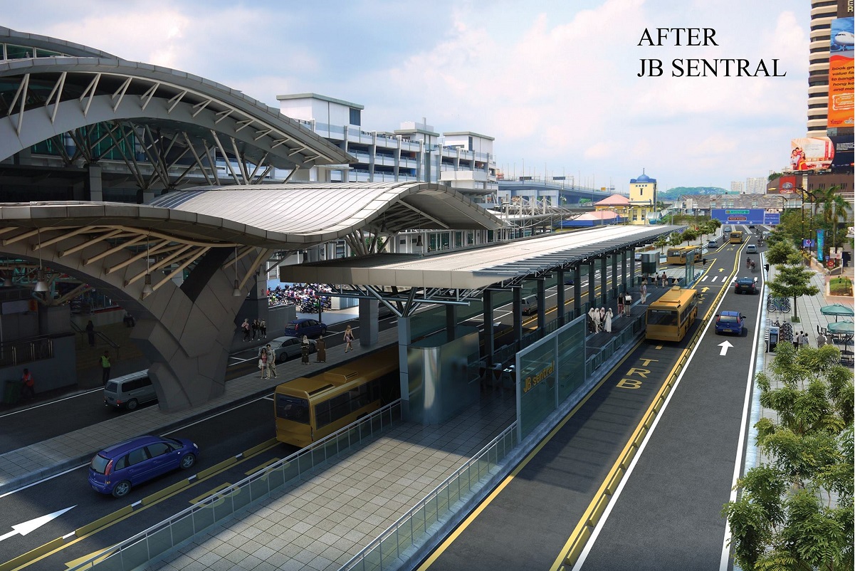
Across the border, a massive bus rapid transit (Iskandar Malaysia BRT, or IMBRT as they call it) is afoot, with completion dates set for the middle of the decade. This well-known image plastered everywhere shown below, is merely just their “trunk” routes, arranged in a radial fashion from the main one-way city loop around JB Sentral.
Besides the four main “trunk” (I’d prefer to call them rapid routes, but really the line between trunk and rapid can be blur sometimes) lines, there’s also a decently dense web of other “direct” and “feeder” routes covering most of JB’s suburban regions. It follows the “hub-and-spoke” model that LTA desperately wants to transform our public transport network into, something I don’t approve of but will let slide (for today), since I won’t be talking about those red and green lines on the map below any time soon.
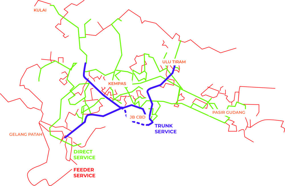
The vehicles they have chosen for each type of route has also been somewhat been carefully thought out, to match the demand levels and trip profiles of each route profile.

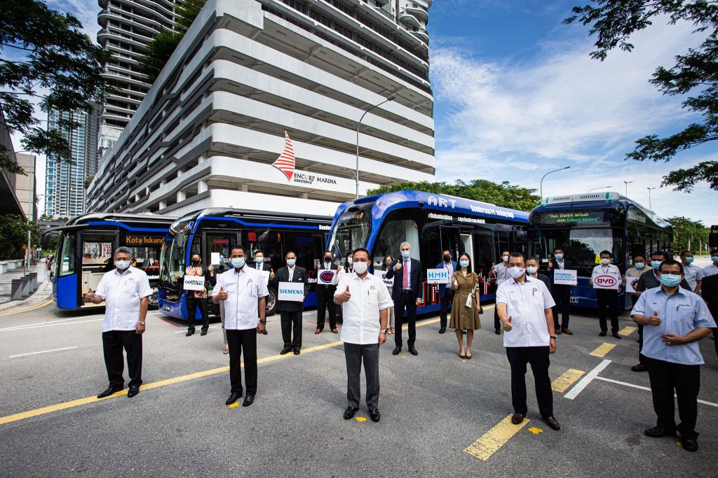
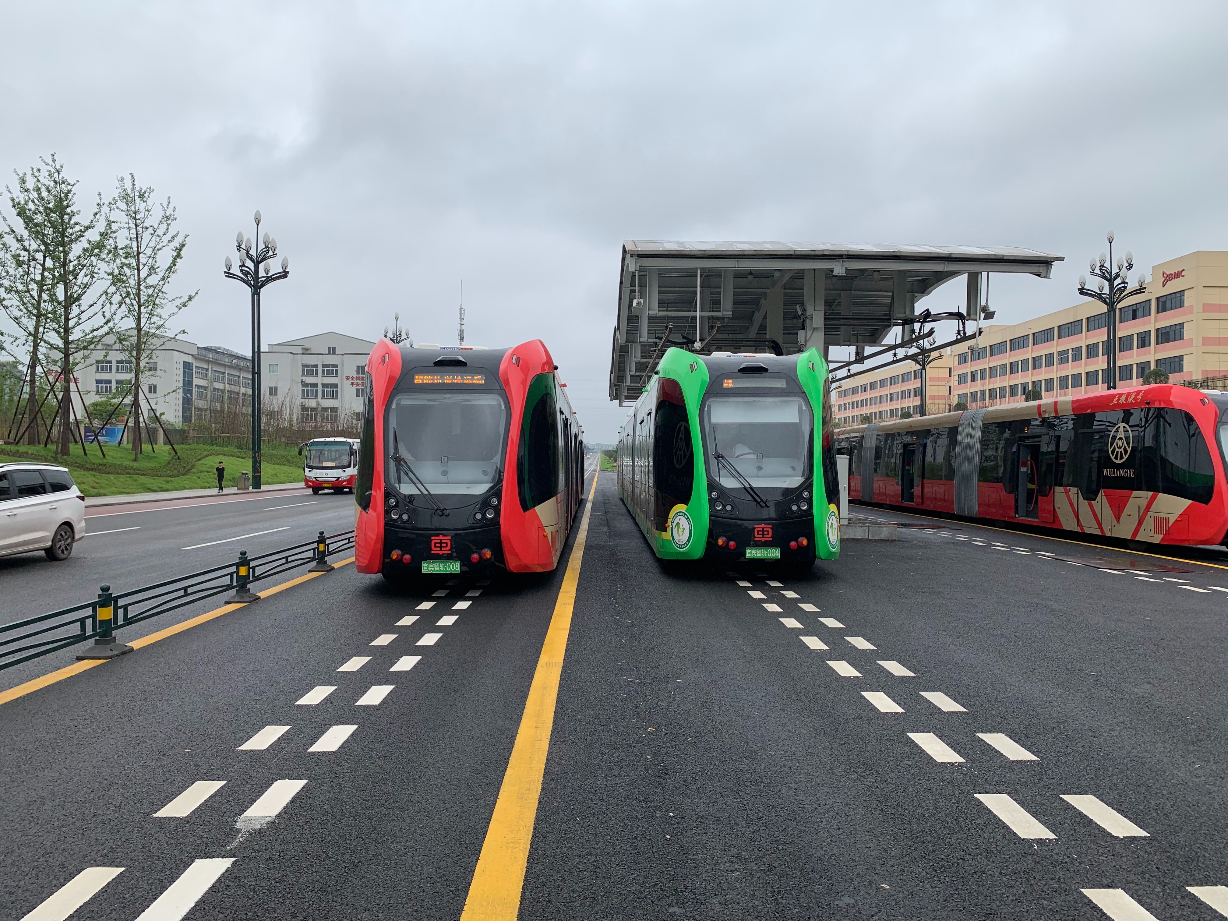
Earlier this year the IMBRT commenced testing its fleet of (all-electric and hybrid) buses, revealing for the first time the actual fleet choices. It turns out feeder and direct routes would be utilising the same 12m buses, with the only difference being in seating arrangements onboard to increase or decrease capacity as needed.

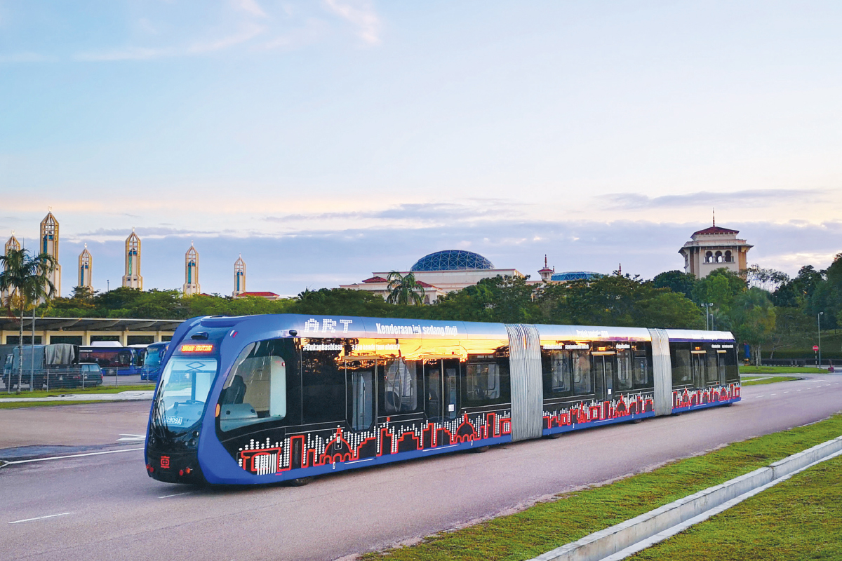
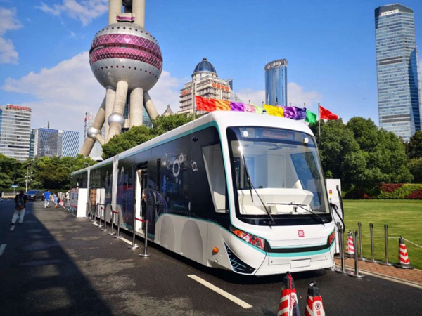
You might see a familiar face there, besides the Gemilang-bodied electric and (bio-)diesel buses (with the signature bodywork resembling our current K9 and K230UB units respectively), that is the ARRT vehicle! Note the striking similarity the image for the proposed “trunk” vehicle had to the present-day ARRT, which really makes me think the people across the border saw coming the invention of that balanced rail-bus hybrid vehicle… It is this exact ARRT vehicle that will be used on the “trunk” routes on the IMBRT system, as well as the focus for today.
Let’s put aside the fleet choices for now, and examine JB’s urban structure.
Johor Bahru – the city
Johor Bahru is, to be frank, a typical American city, heavily centered on the Kotaraya core (which is directly across from Woodlands Checkpoint). It has a dense core with most of the city’s happenings occuring downtown, and then some insanely massive sprawl radiating out from this city center, mostly hugging along the coast with the Straits of Johor (separating us and Malaysia), and of course as one expects: these suburbs are really very low density. There’s some high-rise housing blocks here and there but overall it’s really just wilderness for the greater part. And of course, a few main roads linking the larger of these suburban settlements to the Kotaraya.

These roads, especially the expressways of which Malaysia has some decent quantity (and quality to some extent) of, are huge and massive.

Good for soaking up insane levels of traffic when we Singaporeans flood across the border.

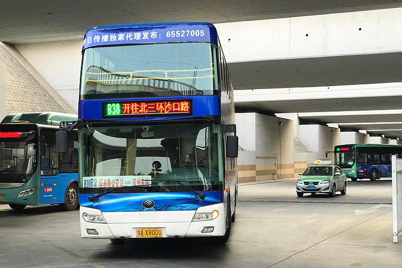
Yet if you carefully measured the level of human traffic flow, you’d realise that they would pretty much fit comfortably in a few bus routes running down JB’s expressways at okay-ish bus frequencies. One or two bus routes alone serving these roads would easily get overwhelmed, but if your level of bus service is something like what is seen along the Tampines Expressway, then things should be all rosy and fine.

If those roads were solely used by cars, then you’d probably be expecting a throughput of about 15,000 ppdph, where more than double that would be wanting to travel (JB has 1.8 million people scattered all over its suburbs and city, and there’s about five or six main expressway routes into the city, do the math.), which causes the rush-hour traffic congestion there (of course there’s also inter-state and inter-city travel involved, a factor that calculations in Singapore can omit), and why buses in JB have, despite all good intentions, been pretty lacklustre up till now.
These corridors, common in Johor Bahru, where development density is significantly lower upon leaving the downtown area, are what I’d call medium-capacity corridors (MCCs). They carry enough people to warrant better than just one or two mediocre services arriving every 15 minutes (that’s good by JB standards, for now), but insufficiently busy to call for a full-blown rapid transit line. (or even light rail, for that matter. KL got really impatient with their bad traffic, had to do something.) MCCs have carrying capacities between 10,000 and 50,000 people per direction per hour, an “awkward zone” which in most cases sees underutilised rail systems (it’s not exactly a white elephant at least, since infrastructure drives demand), or buses that look like they’re gonna explode, even with higher-capacity variants like double-deckers or bendies. The latter, is what Johor Bahru experiences today.
And as I pointed out in the first ARRT post published in January, ARRT fills this capacity sweet spot pretty well with their light rail-esque capacity requiring minimal infrastructure, which saves heavily on infrastructural investment. It is fortunate thus, that JB has picked the right tool for its urban transportation needs, one that wouldn’t cost them the fortune they need to compete with other regional cities, yet one that offers much capacity for the buck. Well done, and I wish the IMBRT project success in the coming years, a model for similar emerging cities to follow. (I just wished they’d make another branch off the Skudai line to serve Senai Airport, but that can come later I guess)
Earlier I noted how the seamless hybridisation of bus and rail technologies brought about the greatest benefit in practically any aspect of transit operations that any logical city would value. But in what case would they work best locally? Some would have noted that ARRT doesn’t have a use in thick, dense cities like Singapore which should be investing more towards full-blown rail — or does it?
Visiting our own MCCs
Some lines of thought go that since Singapore is so much more populated than JB, with hardly any pockets of “nothingness” left (unless you count the CCNR and nature reserves), and with a far higher population density, that MCCs shouldn’t exist in Singapore, right? That it’s either HCCs (high-capacity corridors) or LCCs (low-capacity corridors), without much in between…? As if (increasingly less legit) full-blown rail is the only solution to our public transport demands now?
Err… in actual fact Singapore has plenty of MCCs. More so than JB does, and far too many to be left uncared for, and just given… conventional buses to play with.
Of course, there’s loads of expressways, and tons of people travel on those, including by buses, which is why expressway buses should receive more concern than they currently are. This isn’t all though. Given Singapore’s high density, and precisely because of this greater density (that MCC deniers talk about), practically any road here that has more than three lanes in each direction can be considered a MCC! I’m not kidding, the throughput that larger roads in Singapore face is comparable to the throughput on a JB expressway, simply because we don’t have those empty spaces, and how there’s high-rises literally everywhere!
Take, let’s say, this corridor running from Bishan Park, through Ang Mo Kio Ave 3, Hougang Ave 2 and Eunos Link before ending in East Coast Park along Still Road.

It is one of the most important orbital connectors that provides a somewhat fast and decent connection between North and East, by offering a somewhat straight route that passes important regions, all highly populated or with heavy footfall.
Starting from the western end you have the Bishan Park (and MacRitchie Reservoir + CCNR), before winding its way into the heart of Ang Mo Kio Town (pop. 164k), then to Hougang (pop. 226k), before proceeding on to the vital Defu, Kim Chuan, and Jln Eunos industrial areas each with a high concentration of workplaces, then meeting up with the East West Line at Eunos MRT (pop. 33k) before heading straight for Katong and ending at the renowned East Coast Park.
This corridor has two major “stars” who run a large portion of the route and are frequently overwhelmed during peak hours. Of course, I’m not discounting the role of other bus routes along this corridor, but these two can be considered “the BRT route itself” in “the BRT corridor” (as an analogy to how the Zhengzhou BRT functions)
Service 25 (Ang Mo Kio – Upper East Coast via AMK Ave 3, Hougang Ave 2, Upp Changi Rd N)
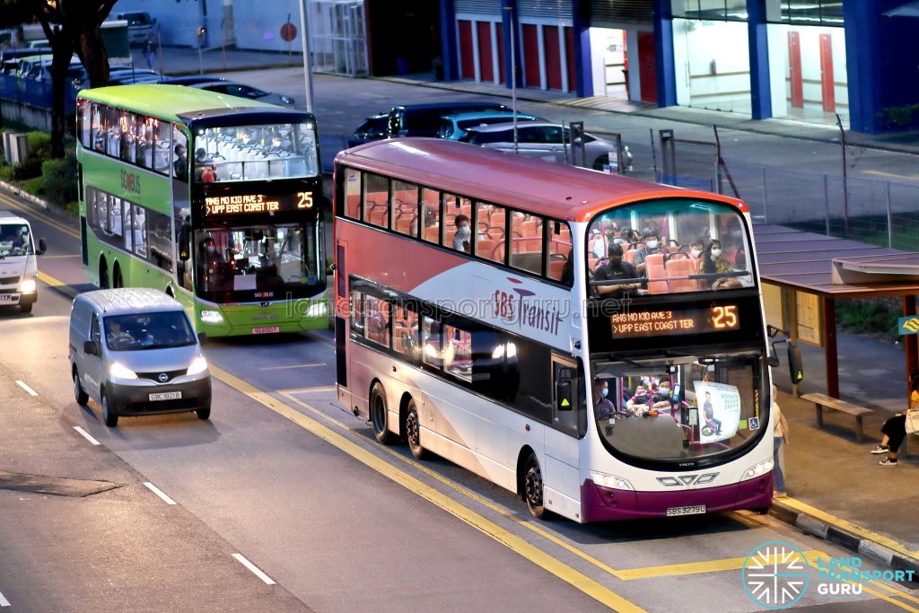
The more frequent of the two, Service 25 acts as an orbital route, playing a similar role to the Circle Line linking the North-South MRT line and Hougang Town (along the NEL) to the East-West Line. Due to the large number of dense population clusters it passes, it is not uncommon to see this route getting packed to the brim (especially from the AMK end in the evening).
Service 55 (Bishan – Upper East Coast via Hougang Ave 2, Eunos Link, East Coast Rd)
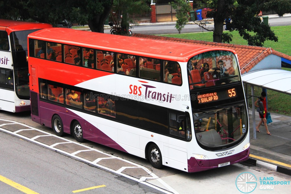
Personally I find this the worse of the two, given its really disastrous frequencies during peak hours and the horrid practice of deploying single-deckers every 15 mins during this timing from the Bishan end, effectively making this a Japanese bus route (not a compliment!!), something I don’t appreciate at all when I want to get home fast. It’s not very well-liked either due to its association with a particularly notorious incident involving a public nuisance…
Just to give you an idea of how busy this route is, here’s the full (exhaustive, if you would excuse me) list of the other bus routes running along this busy corridor: (*inhales deeply*)
- 5
- 8
- 13
- 15
- 22
- 25
- 45
- 47
- 51
- 55
- 58
- 59
- 60
- 61
- 62
- 63
- 65
- 66 (up to 12 December 2021, due to another round of dumb irrationalisation going on)
- 71
- 72
- 73
- 74
- 76
- 81
- 82
- 86
- 87
- 88
- 93
- 94 (Eunos Feeder)
- 107/M
- 112 (Hougang Long Feeder)
- 113 (Hougang Long Feeder)
- 115 (Kovan Feeder)
- 116 (Hougang Long Feeder)
- 130
- 132
- 133
- 136
- 138
- 147
- 150
- 151
- 155
- 162/M
- 165
- 166
- 169
- 261 (AMK Feeder)
- 262 (AMK Feeder)
- 265 (AMK Feeder)
- 268 (AMK Feeder)
- 269 (AMK Feeder)
- 315 (Serangoon Feeder)
- 325 (Hougang Feeder)
- 853/M
- 854
- 966
Whew. That was long. And that should have effectively conveyed the point on just how busy this corridor gets, especially at the Hougang and Jln Eunos sections where lots of other routes converge on here.
Yet it’s also one of the places where building an MRT line… wouldn’t make too much sense. (In CP2001 there was a plan to build an LRT line down this corridor, but that failed, likely for the same reasons.) For one, PAP government logic dictates it’s stupid to build a rail line connecting towns with populations of 164,000, 224,000 and 33,000 to industrial regions. “That’s simply not going to fetch money!” you cry. Okay, fine, you want me to put up with your stinking capitalist mindset, sure. But your buses along this route are so busy, even if they’re running five-minute frequencies like 25 was used to before COVID hit! Doesn’t this show that we need something of greater capacity than just individual double-deckers? I know those carry 120, and I appreciate that there’s been an effort to bump up individual bus capacity from 80 (single-deck) to 120, but seriously, that is not enough, ostensibly seen from the overcrowded buses we’re still getting even after rounds of bus improvement!
There’s multiple such corridors in Singapore, intersecting each other at (mostly) right angles, which forms for a dense blanket of potential MCCs here that we could make the most use of, if only we knew how to exploit varying transportation technologies out there! This dense network blanket of MCCs, if done right, could potentially act as an alternative, complementing the MRT’s capacity which we all know by now is a total joke on the international stage, adding extra capacity to our overall public transport system as population continues to rise…
Road-based rapid transit
As I went around snooping over the web, and certain comments came in, I came to realise that ARRT… isn’t that special after all. It’s special for being the best to blend the characteristics and advantages of bus and rail, but it’s not exactly the only of its type, something I think I might have worded the previous post to sound like.
True enough, the ARRT isn’t exactly in a unique or special spot, as technological developments continue to stream in. It was indeed a pioneer, but four years in, there has been more “ARRT-class” systems devised, under different names, but with essentially the same essence.
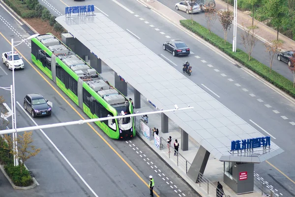
Here’s the ARRT in its original form. The three-car variant, in its original prototype green livery, running on (originally) paint tracks, designed by CRRC Zhuzhou.
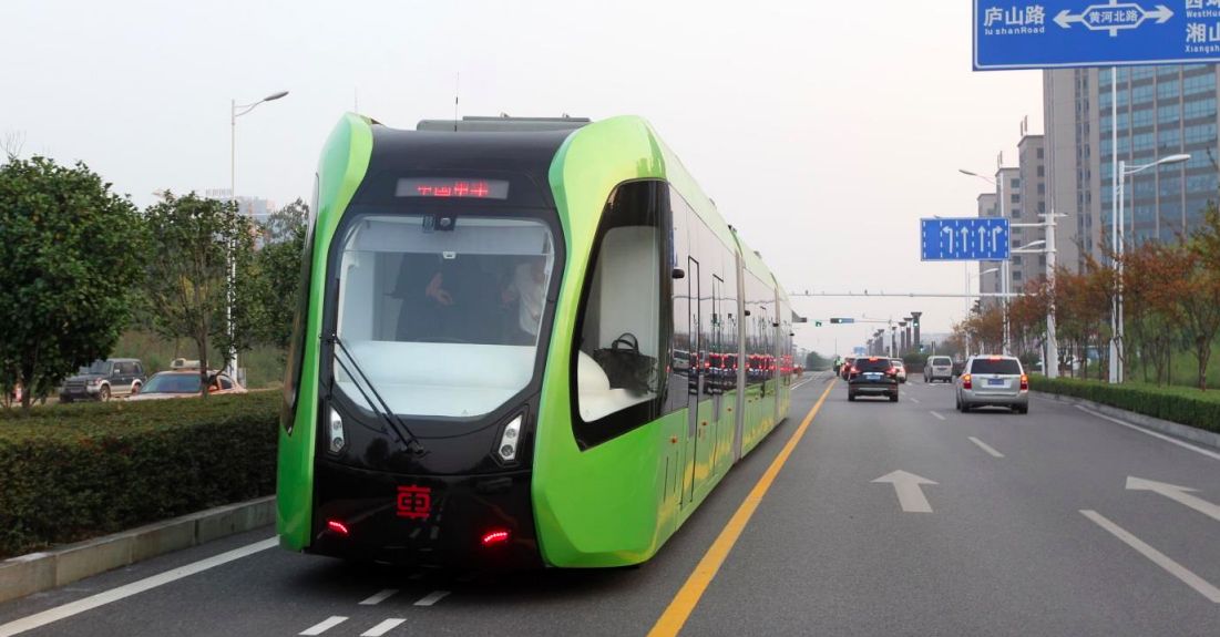
Later on in 2020, CRRC Nanjing Puzhen (which also does the refurbishment of the C751A units for us) devised a similar system, albeit using a slightly different way to guide the vehicle, and looking more like those intercity coach buses, but in its essence it belongs with the ARRT system. It has a… let’s just say very copycat name: Digital Rail Rapid Transit (DRRT), and is being tried out as a tram line in Shanghai.
Unlike the Zhuzhou ARRT, this one follows a brute-force coded path, which might score it some negative points for flexibility. Nevertheless we’ll see how this fares as its implementations increase.
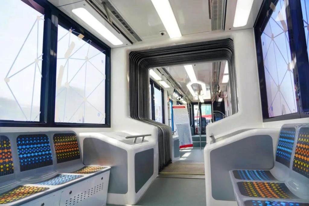
Similar interior can be found for the DRRT. The wider body is much more appreciated, a feature that the original Zhuzhou ARRT lacks.
More similar technologies may be afoot in the coming years, with the same idea of running a 3-car or longer vehicle on the road and operating it as a medium-capacity transport system. They share more similarities than differences, so I think it’d be better if we referred to them as “road-based rapid transit”. (RBRT)
Of course, when we talk about RBRT we must not forget the elephant in the room that preceded all of these 2020-s era flashy stuff: the good ol’ conventional bus rapid transit (BRT) system. Conventional BRT would also fit into the definition of RBRT, so why not.
Characteristics of RBRT
RBRT takes on many forms, spans many different time eras, and may look vastly different, but fundamentally it has a few characteristics that all of them share in common.
1 – Capacity
The “rapid transit” part of the term RBRT should probably suggest what its role in a public transport system will be like already — as a key, if not the most important component, forming the backbone of the overall public transport network. It is only logical that whatever form RBRT takes on, it must have sufficient capacity, because as the centerpiece of a network you’re gonna be transporting large numbers of people across vast distances, thus requiring that your vehicles have high capacities, because while you may be able to increase frequency all the way, there are technical limits that form a limit to how far you can go, or in the case of quite a number of systems the manpower issue becomes a concern too. For maximum efficiency, just go with bigger vehicles, lol.


2 – Minimal infrastructure investment
A key reason why RBRT has a decisive advantage over say, trams or light rail lines, is simply because of the cost advantage that RBRT has in the form of minimised infrastructure investment required for RBRT systems! Viaducts, tunnels, massive stations (cough JRL), signalling, you get all that, cost an insane ton, racking what could have been a project in a few million dollars into a multi-billion dollar project (and the target of corruption and the like)! This technically disqualifies systems like the Xiamen BRT and Brisbane Busway that use extra infrastructure specifically for the RBRT system itself…
RBRT systems typically use existing infrastructure, and the rights of way obtained through taking them away from existing roads or other available space nearby.

3 – Rights-of-way
Ideally, RBRT systems should have their own right of way. This is a no-brainer, since again the “rapid” part of the RBRT name suggests an idea of it being a fast travel option, comparatively. How do you do that, if you’re always stuck in traffic then?

4 – Speed
An extension of point 3, not only should RBRT have high capacity, require little investment, and be right-of-way separated, they should also be fast. Again, being the core part of a transport network means that RBRT will be playing, just like in JB’s case “core trunk” roles, that get you from one part of the city to another. You’ll need to be decently fast because people have, well, travel time expectations! Separating rights of way of RBRT from general traffic is merely one of the ways to achieve this speed benefit that RBRT brings about. Other than buying vehicles with good pickup and high top speeds for the job, there’s one aspect that RBRTs should be taking note of, that is the possibility of running into RBRT vehicle congestion, which could doom a well-intentioned RBRT for good.

5 – Network effect
For RBRT to truly realise their potential, they cannot exist as standalone lines! Besides just having the infrastructure, you need to have it in sufficient quantity, in order for the connectivity benefits of RBRT systems to be realised! RBRT systems work best when there’s multiple lines going different places, with excellent connection points, because the network effect isn’t a linear increase in the benefits brought about by any form of transportation — it’s a compounded increase, as you can now travel freely in two dimensions with a vast network, instead of just one dimension for systems with only one or two lines!

A vision for Singapore’s future public transport
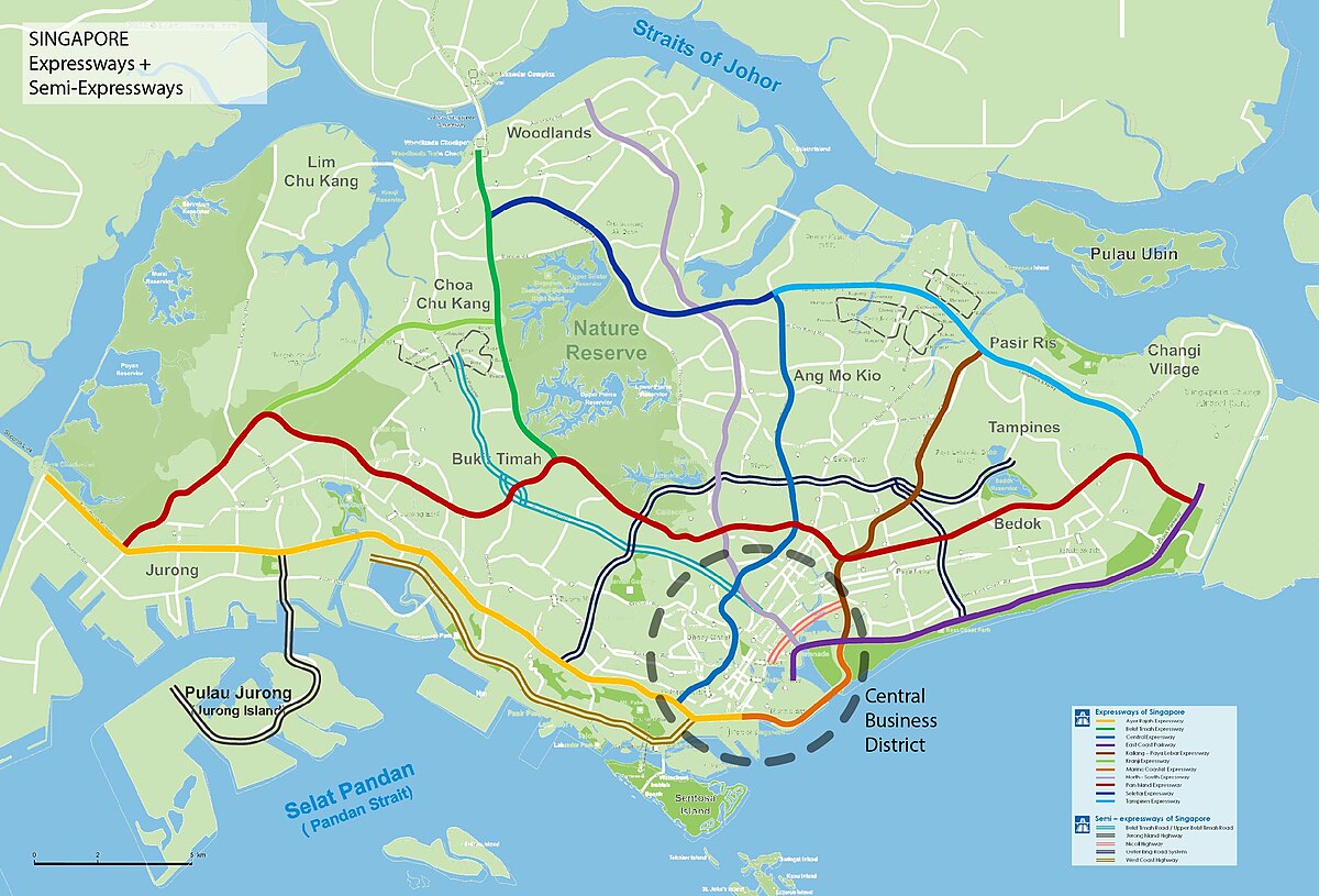
This is our present rapid transit map. It consists of rail rapid transit only in the present.

It’s glaringly obvious that using the MRT alone leaves massive gaps in the network that may underserve vast swaths of people who don’t live within the 200m radius of an MRT station! Sometimes, hundreds of thousands are left out in one go! And buses, conventional buses alone, simply aren’t enough to handle the demand levels! Yet this demand, while overwhelming conventional buses, isn’t enough to justify a full blown rail line!
There’s also another problem. As our MRT system ages, it becomes more prone to breakdowns, train faults and the like. Every time this happens, millions, I’m not kidding, get stranded, left unable to travel to where they want to go. This is the result of a heavily rail-centric transportation policy that has driven LTA for the past three and a half decades!
As anyone knows, it’s full-on pandemonium! And even during peacetime the buses on major trunk corridors get overwhelmed still, even with insanely high frequencies and massive buses being deployed! That’s before you consider what LTA is trying to do in their 2040 LTMP, essentially relegating buses to second-class transport, existing solely to feed the MRT system, through endless rounds of irrationalisation that essentially leave passengers with no option but to take the increasingly unreliable trains. -_-
What if, instead of forcing everyone onto MRT trains that are increasingly becoming inadequate due to systemic capacity shortcomings, we gave them an alternative, a possible alternative route, so that they could pick that instead of the trains?
A road-based rapid transit system that covers Singapore in a denser blanket than the existing rail network does, providing multiple alternative routes for each given rail line! This would vastly increase the overall capacity of the transport network in general, for… let’s just say the cost of trying to retrofit and refurbish trains for nothing.

An added benefit of such an RBRT system would also be the gradual transition of the rapid transit network in Singapore from a heavily radial-centric system towards a more grid-like fashion, especially important as Singapore decentralises in the coming years with activity areas being scattered all over the island, essentially breaking rigid urban-suburban land use patterns. Radial systems, even when coupled with orbitals, is simply not going to do the job adequately.
Instead of trains that are getting filled to the brim even with 100-second frequencies being run (assuming they’re even being run in the first place), and all pointed in the direction of the CBD only, why not an extensive RBRT system that covers all of Singapore in a dense blanket, on MCCs linking all sorts of destinations, frequent connections, and service that’s just good enough to make it an appealing travel option!

Because at the end of the day, whether you travel in a bus or a train, on rubber tyres or on steel rails, doesn’t really matter. What matters, is that you can get to your destination quickly enough, and transport people in sufficient number so that you don’t get left behind. And of course, that you can get to where you want to be through whatever transport system there is in a city.
MCCs exist in large quantities in most cities, and that, is where RBRT systems play out to their best, and where we should be looking seriously at possibilities of implementing RBRT systems. Singapore has many of them too, and RBRT will be an excellent addition to the rapid transit system, and I’ll bet you a handsome fortune that they’ll work far better over here, than anywhere else, precisely because of our high urban density that naysayers of RBRT systems claim of!
For my alternative TM2040 I’m studying two options right now: Zhuzhou (and JB’s) “line-based”, closed approach that has a greater capacity advantage:
And Zhengzhou’s corridor-based “open” approach. It comes at the cost of capacity since it doesn’t allow uniformly “large” fleets like what Latin American BRT systems or ARRT/DRRT systems do, but its primary advantage is, like I pointed out in the earlier ZZBRT post, integration with the bus system which allows the effect of improved service to be felt beyond the infrastructure itself.

Whichever option it is, as RBRT both play the same role, one of providing decent alternatives to the MRT, and that alone is something worth looking forward to. There is a limit to what we can do with existing rail lines, and we really do need to start looking outside the box.
Liked this article? Sub, like and share this post, to spread the love around! E:3

16 thoughts on “Medium-capacity corridors and road-based rapid transit”